Wednesday, February 24, 2016

Top 10 Service Improvements // #2 - Cornelius Pass

Cornelius Pass is the 148th Ave of the Westside. It should have a bus line on it, but it doesn't. According to my concept map of proposed TriMet service improvements, it will.

Cornelius Pass Rd is one of the main north/south routes in Washington County. Named for the very dangerous pass that traverses the Tualatin Mountains north of Sunset Hwy, the road has evolved over time and continues to grow as the area around it blossoms.
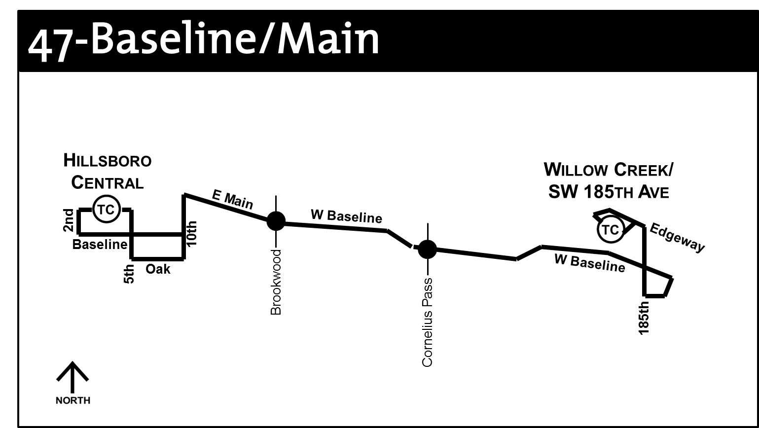
Cornelius Pass & Baseline, a major intersection with no bus service.
It started out as three different roads: Cornelius Pass from Hwy 30 to Cornell, 216th Ave between Cornell and Baseline, and 219th Ave from Baseline to TV Hwy. In 1996, the intersection with Baseline Rd was redesigned, and the Cornelius Pass name was extended all the way to TV Hwy. There have been quite a few tumultuous construction projects on the road, such as widening the road south of Baseline twice, replacing the bridges at Beaverton Creek and Rock Creek, and now widening the road to seven lanes between Cornell and Sunset Hwy. Now it is a rather busy road, connecting homes, apartments, businesses, retail, and schools.

Cornelius Pass and Brookwood Pkwy are the only major north/south roads in Hillsboro that go from Hwy 8 all the way to Hwy 26. TriMet has always maintained that Cornelius Pass isn't a good candidate for transit because of the lack of connection to MAX. That's silly. One could make the same case for Murray Blvd, but they got around that hurdle, didn't they? If you add one north/south bus line at Brookwood (or Brookwood and 229th, as I designed it), you are still left with only one north/south line from SE 10th to SW 185th.

So I propose Line 49-Cornelius Pass Rd.

This bus line would start at PCC-Rock Creek and travel down West Union Rd to Cornelius Pass, providing access to the West Union and Rock Creek communities north of Sunset Hwy. (There used to be rush hour service there on the old Line 89, but that went away years ago.) The bus would then cross Sunset and pass the Sunset Fred Meyer shopping area, crossing Evergreen (Line 46) and Cornell (Line 48), serving the east edge of the Orenco district.

So how do you get to MAX you ask? Simple logic. Turn the bus on Amberwood Dr just south of Cornell, a direct shot to NW 206th Ave. Taking the bus to 206th would not only provide access to Quatama MAX station and all its surrounding apartments, but also the AmberGlen business district that Hillsboro is so gung-ho on developing (they have even proposed a cable car circulator, which TriMet has never sounded too excited about). After stopping inside the now currently unused bus bays within the Quatama Park & Ride, the 49 would travel west on Quatama Rd back to Cornelius Pass. This would mean that the entire time the bus was not on Cornelius Pass Rd it would be serving something. And by something, I mean the thousands of people who live in the homes, townhouses, and apartments in the AmberGlen and Quatama districts.

Now we take the bus down Cornelius Pass straight through to TV Hwy. This is where my great ideas came to a halt. What do I do now? Simple: take TV Hwy one-half mile east to 209th, and turn right, making a quick trip to Kinnaman Rd. This oddly diagonal road is the main east/west route between TV Hwy and Farmington. Along it are Aloha High School, Mountain View Middle School (a block away at Farmington), Kinnaman Elementary School, Farmington Center Shopping Center, and the Edwards Center, a home for people with developmental disabilities. Maybe the road isn't as high profile as Cornelius Pass, but it's as important as any road in Aloha. This road would produce many more riders in the South Aloha area. During late hours, Sundays, or the like, the route could turn around at TV Hwy and Cornelius Pass via Johnson and 214th Ave.
Old TriMet 49s-Quatama map, 1999-2003

AmberGlen
This section of the route is historically important, and is in fact the reason this new line is numbered 49. You see, when Westside MAX opened in 1998, TriMet began service on a route called 49s-Willow Creek (when they used 's' for shuttles and 'X' for express lines). Within two years, they re-routed the line to Quatama MAX station instead of Willow Creek (see TriMet's old page for it here), and it became the 49s-Quatama. This bus served the AmberGlen corporate park that was in development, but the corporate part kind of peaked well before it was completed and ridership never lived up to expectations. So in 2003 they eliminated the line.

Though the business complex growth leveled out, and almost died out during the recession, the City of Hillsboro had other plans. They saw AmberGlen as a major community development opportunity (see this for details). Their dream looked like the intermingling of business, multi-format residential, and even an OHSU facility. They have started building some homes in the area now, but nothing as substantial so far as their grand vision.

However, considering the improved economy and the overall growth of Hillsboro over the last ten years, AmberGlen is as good as any for a spike in growth to take place. And this Line 49 can work right in the heart of it. The bus would travel down 206th Ave all week, but notice the dotted lines on the map for my new line above. This represents a rush hour side-routing that could be taken every other trip or so, or even a quick loop that could turn right back to the MAX station a few times. It covers all the area that was served before while continuing to place an emphasis on the residential areas nearby.

South End?
Notice that I didn't say anything above about where the line ends on the south end. That is because I really don't know. The line would take Kinnaman to Farmington, and then there are a few options. You see, I designed the line before TriMet released their concept map of the Southwest area, which included the extension of Line 67 from Merlo Rd to Tigard TC via 170th, Hart, 155th, Brockman, 125th, and Walnut (or in my plan, Gaarde). My plan took Line 49 to Willow Creek via 170th and Baseline, as shown in the map above. Obviously, if the 67 were extended, this would be a lot of redundant service on 170th, a road with a lot of life to it but not necessarily enough for two bus lines for that length of the road. I love my old 170th plan for the 49, but that its terminus would probably have to be reworked. The best idea so far that I have is to take the 49 down Farmington to 160th, which would become Millikan and have it end at the Millikan Way Park & Ride. This in itself is a very decent plan, but more study would have to be done to determine if it would be cost-effective and would generate enough ridership.

Expansion
Have you ever noticed that large field south of TV Hwy near Harvey the giant bunny? That has always been outside of the Urban Growth Boundary (UGB) and no one could develop it. However, Hillsboro has annexed it and is now ready to start work on the new South Hillsboro community they have planned there. Basically, they will extend Cornelius Pass Rd to Rosedale Rd, and many of the other through-roads on the west and east will converge at Cornelius Pass. Over 8,000 new residences are planned for this area. (See Hillsboro's page about it here). My plan is to take the 49 from Cornelius Pass to Kinnaman via TV Hwy and 209th, but it is designed to take this new area into consideration. The bus could be re-routed down the new Cornelius Pass extension all the way to Rosedale and back up 209th, which would create good transit access for all those houses off 209th also. Or, as one of their concept maps shows, take Cornelius Pass to Kinnaman, and turn left (seems too simple...). Either way, this flexibility would do a large part to make the 49 a successful and thriving bus line for years to come. Turns out that Hillsboro is going to break ground on the Cornelius Pass extension this summer, so these plans for the area all may change before the bus even goes into service!

Think I may be being a little too passionate about one road? No. I've spent my whole life watching this road grow. It's time to give it the bus line that it deserves.

Do you have any questions or comments? Email me at comments@transitriderpdx.com with any input you may have. Also, if you like anything you see here and want TriMet to hear about it, you can email them and reference my ideas (or submit ideas of your own) at future@trimet.org.

(Image credits: Intersection picture, M.O. Stevens via Wikimedia Commons, Old 49s Map via Wayback Machine.)

Tuesday, February 23, 2016

Top 10 Service Improvements // #1 - Hillsboro

In advance of this Thursday's open house where TriMet will be meeting with riders about their plans to expand bus service, I am unveiling my Top 10 suggested service improvements. All of these were explained in my last post, but I will go into some greater detail concerning routings, and rationale. Please note: these are changes I believe must be made for the TriMet system to reach its potential. So read carefully; you might find this information extremely helpful.


Hillsboro is one of the most forgotten cities in the Portland area as far as transit. Its original design was based around the question, "How can we get everybody out there from Downtown Portland in one shot?" It was decent for commuters but not the local Hillsboroan. Then came Westside MAX, which paved the way for expanded service. However, these plans became dated quickly as the city grew and the designs weren't following the flow of people anymore. So after 18 years, it's time to start afresh.

Hillsboro is the fifth most populous city in Oregon, with right around 100,000 people. It is ethnically, culturally, and economically diverse, with thriving communities and growing businesses. Everybody knows how important Intel is to the city (employing 60% of the sum of the employees of the top ten employers); but Hillsboro has many more businesses, from very small to very large, and its economy has continued to do rather well even during the Great Recession.

But did you know that between TV Hwy and Baseline Rd/Main Street, there is no north/south bus route for 4 1/2 miles? This is something long overdue for change.


TriMet has made two major enhancements over the last ten years to lay the groundwork for the future: (1) establishing Line 57-TV Hwy as a Frequent Service line and one of the busiest lines in the system, and (2) re-routing Line 48-Cornell to stay on Cornell from 10th & Main all the way to Cedar Hills Blvd. These routes give you as a designer something to build around.

Currently, there are only three other bus lines that travel into Hillsboro: Line 46 through North Hillsboro on weekdays only, Line 47 on Baseline, 229th, Evergreen and up to Bethany also on weekdays only, and Line 52 on 185th Ave through Tanasbourne. (See TriMet's system map for context). On Sundays, for example, along with the 52, only the 48 (hourly) and 57 (15 minutes) are running through the city. The only major city in Portland with worse weekend service is Tualatin.

So what do we do about it? Below are my suggestions for taking this sorry group of four lines and tweaking them just a little to result in six lines, no lost significant service segments, and all the system coverage any Hillsboroan ever wanted (within reason, of course).

Voila! Your new Hillsboro!
57-TV Hwy/Forest Grove & 48-Cornell
      No changes to these lines should at all come as a shock, as they are already progressing fast along their evolution toward the ultimate goal. Line 57 currently runs every 15 minutes on weekdays (6am-9pm), Saturdays (9am-6pm) and Sundays (10am-6pm), with 20 minute service for most of the surrounding times. Span of service is not an issue. The only improvements that could be made are adding a few more early morning/late night trips, expanding 15-minute weekend service by a few hours, and maybe throwing in a couple of rush hour trippers out of Beaverton TC. All this could be done at one service change at little cost to the agency. Line 48 should eventually be Frequent Service as well, as it provides the other half of the backbone of Hillsboro, as well as the rest of the communities in the west and northwest metro area. The bold lines on this map indicate that these lines, as well as the 52, are Frequent Service.

47-Baseline/Main
      Yes, I split Baseline and Evergreen. I know the names go together like salt and pepper, Kelso and Longview, and Kirk and Spock, but these are two roads that really should never have been on the same line. If TriMet wants the "grid" that they envision that looks like East Portland, then there should be four east/west routes: TV Hwy, Baseline, Cornell, and Evergreen. After much deliberation (actually way more than any sane human should use), I concluded that the Baseline bus should be the 47 (and the Evergreen bus the 46) for two reasons: (1) everyone is familiar with saying "47-Baseline..." every time they say the route name, and (2) this way the lines would leave Hillsboro TC the same way as they do now, avoiding confusion.
      My routing of Line 47 is simple. It would leave Hillsboro TC via Oak/Baseline, 10th, and E Main as it does now, continuing on Baseline all the way to 185th. There it would turn in to Willow Creek TC. Would it continue? Maybe. In my current design, I have another line serving Baseline from 185th to 170th. There's really no pressing need for a line down Jenkins from Murray to 170th (only thing there is Costco and Nike, both served by the 67, and in the latter's case, two other lines). So, in my opinion there isn't a need for a bus to run all the way from SE 10th to Cedar Hills Blvd. I should know---I work on Baseline Rd!
      Line 47 would run all week, with 15 minute service during peak hours and 20-30 minute service at other times. With this line splitting the 48 and 57, we now have a logical and efficient east to west system through the heart of Hillsboro.

46-Evergreen
      I also spent a lot of time trying to figure out exactly what I needed to do to get this line to work. What I wanted was a line that ran straight down Evergreen. But I also didn't want to leave out the Griffin Oaks and Brookwood/Main Library sections of the current 46, which serve a significant amount of businesses. Then I had an epiphany: there is almost nothing between 15th and Brookwood due to the presence of the Airport! So, I routed the new 46 to serve all of the current 46 area. I decided that it should travel out of the FairPlex MAX station via Veterans Dr, as it wouldn't skip any stops, it would allow for stops on Brookwood at Veterans (for the area between Main & Cornell) and at Cornell (where there currently are no 46 stops due to inaccessibility, and it would allow for access to anything the City of Hillsboro decides to put on Veterans Dr. Also, it wouldn't serve Dawson Creek Dr or Shute Rd, which is unfortunate. I just couldn't come up with a logical way for the route to pass through and cover those businesses at the same time. Fortunately, Brookwood provides access for most of those businesses at a reasonably short distance.
      TriMet's concept map shows no fixed route service through the Glencoe area. Rarely would I say something like this, but frankly that is absolutely stupid and ridiculous. Look at the above map, particularly the darker area of the background that indicates the city and metro area boundary. Now remove the green line in your mind. Notice how much area is now lacking transit coverage? That would be about 20% of the city, or, taking the average population, about 20,000 people, more than nine legitimate cities in the Portland area! The Glencoe area may have lower ridership, but that's what you get when your bus comes only every 60 minutes at its best. In this case, better service would equal more ridership.
     The big question on everyone's mind will be this: What about all the Intel employees who ride from Bethany to work everyday? Didn't TriMet just make the service change to send the 47 to PCC-Rock Creek for those employees? Yes, they sure did. And so far, we don't have full buses. But never fear! My plan actually works better for you. You see, instead of the Evergreen bus stopping on 229th in front of the Ronler Acres campus, it will stay on Evergreen, where there is another entrance on the north side of the campus. Also, due to it enveloping the current Line 46, it will also serve the Jones Farm campus! So there's two Intel campuses for the price of one (literally). Fifteen minute rush hour service for some parts, half-hour service the rest of the week. I think that with these modifications to the Evergreen line, it will bring a real boost to ridership in all these areas.

42-Brookwood/229th
      So I bet you were wondering what I did with 229th Ave. Trust me, it didn't get forgotten. Actually, that was where I spent most of my brain matter in redesigning Hillsboro. I wanted a main north/south line, but I didn't want to leave Brookwood out. Once I realized that I could have the 46 serve Brookwood by the Main Library, all the pieces started coming together. Actually, the same logic that I used for Evergreen was applied to this line. You see, there literally is nothing on Brookwood between Cornell and E Main. One street starts just north of Main, but that's in walking distance from Main. Look at Google Maps. See? There's not even a house on Brookwood right here. So, therefore, no reason for a bus line. So then it hit me: Why don't I send the bus from Brookwood in the south to 231st in the north? Perfect. So where would it end in the north? All it would need to do is hit Evergreen and meet with the 46. I then realized that I could turn the bus around via Bennett and 235th; it would serve both the north entrance of Intel and the Hillsboro Stadium, something that has never had direct access via transit. And the line would be short enough, it wouldn't need a layover spot. That's all it needs to do in the north.
      What about the south? I started looking at maps and realized that there is a whole new area of civilization south of TV Hwy that has no transit access. I even found the mysteriously missing Witch Hazel Elementary School. Take the bus down to Davis, turn right and you hit River Rd. This would mean all of South Hillsboro, Witch Hazel, and the area around HilHi would have transit! Then I took a daring step further: I had it cross TV Hwy. River Rd becomes 13th, which hits Maple, where the bus can go back across Hwy 8 to Seventh Ave. Then it would get back to Oak and Baseline to get to the transit center. Yes, those turns are a little tight, and you could very easily have it just go straight in from River Rd via Hwy 8. However, I think with this extra coverage it can help increase access to those parts of inner Hillsboro that represent some of the least rich portions of the population. This bus would only have to run every 30 minutes to an hour on weekdays and Saturdays, but you would have the flexibility to put a lot more service in areas where it's needed during peak times: 229th between Orenco Station and the Hillsboro Stadium.

49-Cornelius Pass Rd
      This is the most controversial portion of my concept plan. It also has some of the most logic and benefits. There has been a lot of thoughts and planning on my part to design Line 49. Even a lot of driving as I wanted to make sure I got it right. I live within a half mile from Cornelius Pass, so if anybody should know anything about it, it would be me. I've lived in the same place all my life and have watched the city grow around Cornelius Pass to make it one of the most important thoroughfares in the whole Metro area. And TriMet still doesn't want to put a bus line down it.
      Stay tuned for Part 2 of this ten part series, as I break down in even greater detail all the cool things that make my Line 49 one of the greatest potential additions to a system that is evolving into one of the greatest transit designs in the country.

Do you have any questions or comments? Email me at comments@transitriderpdx.com with any input you may have. Also, if you like anything you see here and want TriMet to hear about it, you can email them and reference my ideas (or submit ideas of your own) at future@trimet.org.

(Image credit: Main Street Bridge, Cacophony via Wikimedia Commons.)

Saturday, February 20, 2016

Progress, Part 2

How should the TriMet system look? Here's my take.

Why does the 62-Murray Blvd turn from southbound Murray onto Scholls Ferry? Well, because less than ten years ago Murray ended just south of the intersection. But they built a bridge and connected Murray into Walnut and made them one road. Now it is a thoroughfare between Cedar Mill and Tigard.

Part of improving service is recognizing what has changed in the context of our preexisting bus lines and adapting them to actually serve the people in those areas. The reason TriMet is focusing their attention on the Westside (Hillsboro, Aloha, Beaverton) and the Southwest (Tigard, Sherwood, Tualatin, Lake Oswego, SW Portland) is because these areas are so inadequately served or their lines are so outdated that they don't follow the flow of passenger demand anymore. Some areas, like Bull Mountain, have thousands of people living in them (paying taxes to TriMet just like the rest of the city) and have not one bus line within walking distance. This, to me, is quite sad.

I am stoked that TriMet is starting to look at improving these areas. It's only fair to the people who are forced to give them their money. But as a person who sees mass transit as the backbone of a society with the potential to bring so many benefits to all residents, any improvements are welcomed, and if we can do anything to encourage more people to ride, then we should make that a reality.

TriMet's Plans

At future.trimet.org, the people who are employed to make those planning decisions have begun laying out their vision of what the system of the future will look like. It's a work in progress, but I'm impressed by how aggressive they have been in retrofitting the outdated design. Their Westside plan is well-meaning but somewhat haphazard. As a resident of the area I know that it doesn't sufficiently answer all of the problems that we are facing around here, but it's a start. The Southwest plan, however, is very intriguing and is quite logically thought-out. You can read the Final Report here and review the map on Page 9 of that document. They have basically turned the current line layout on its head and replaced existing under-performing sections of lines with needed coverage of major roads and new areas.

Also, there are draft maps for the North/Central, Eastside, and Southeast sections. These are very insightful and reasonable, answering a lot of the issues that are glaring in those areas. (Most of what I cover relates to the Westside and Southwest, as I live in these areas and see firsthand how problematic the current designs are here. But I think their ideas about the other side of the river are, for the most part, entirely sufficient.)

I have been working on a system redesign for a year or so, particularly identifying areas of major need. I have analyzed their draft line-by-line, and am impressed to see that they have covered many of these same areas. It proves to me that they are on the same page as the rest of us as far as recognizing needs.

If you have comments, suggestions or ideas about their plans, you can weigh-in at by emailing at future@trimet.org or taking the variety of surveys at the respective pages of the different parts of town.

My Plans

I had created an entirely new system plan on a website called Transitmix, which allowed users to use real maps to design their own transit system. Unfortunately, I lost access to that map because they went public and now require that you request that access. (I did request that access and haven't heard back from them.) However, I was so intrigued with the ideas TriMet made on their draft that I basically created a new system design integrating their plans with my additions or improvements to their plan.

Below is a line-by-line analysis of my proposed improvements to their plans. These descriptions will first explain TriMet's new vision for the line, then will explain my improvements to that plan. This is not an exhaustive list of their new ideas, because there are so many proposed changes that it would take weeks of writing to explain them all to you. So therefore, this list features highlights of my ideas and how they affect TriMet's. If there's a map, then that's a cue that I feel my suggestions here are of the utmost importance to the system.

(Please note: Obviously, the following maps are not real TriMet maps.)

4-Division/Fessenden Taking future BRT into account, buses can run between St Johns and SE 92nd & Division, connecting to the local 82-Powell Blvd which would run on Powell between 92nd and Gresham TC. I have heard talks of TriMet splitting the 4 into two separate lines, which would be useful especially if BRT is not in service down Powell & Division.

9-Powell Blvd Line 9 would be discontinued if BRT service goes into effect. Service west of 92nd would be served by BRT; service east of 92nd would be served by Line 82.


12-Barbur/Sandy Blvd When MAX Red Line breaks, there is no fixed transit service to Portland International Airport. Before the Red Line went to PDX, Line 12 turned north on I-205 and then onto Airport Way to serve it. As the 12 no longer goes to Gresham, 12 buses should continue through Parkrose/Sumner TC to PDX via I-205 and Airport Way. Buses could layover at Parkrose each way so that no layover would be required at PDX.

14-Hawthorne/122nd Line 71 is finally scheduled to be split into two routes. Line 14 is very short, so it makes sense to combine the 122nd section with Line 14 and make it one line, with 15 minute service every day of the week. Line 14 would run between Portland City Center and Parkrose/Sumner TC via Hawthorne, 50th, Foster, Lents MAX Station, 122nd, and Prescott.

16-Front Ave/St Helens Rd Buses would continue through Portland City Center via 5th and 6th Avenues and across the Harbor Structure and the Tillikum Crossing, Bridge of the People to OMSI or even Center Garage.

19-Woodstock Service can be enhanced on the Woodstock/Glisan line if the line if split into two lines. Line 19 would run between Portland City Center and Happy Valley via the Ross Island Bridge, Powell, Milwaukie Ave, Bybee, 28th/32nd, Woodstock, 52nd, Duke, 82nd, Flavel, Mt Scott, 152nd, and 157th. Rush hour service would provide extra trips between City Center and 112th & Mt Scott. The old Line 157 used to serve the heart of Happy Valley, but nobody rode it. Imagine having a 20-minute bus running service direct to Downtown Portland via the Flavel St MAX Station. Do you think people would ride it then?


23-San Rafael/148th Line 23 would run between Gateway TC and SE Powell & 148th via 102nd, Halsey/Weidler, 111th, Stanton, 122nd, San Rafael, 132nd, Sacramento, and 148th. The line would turn around traveling southbound on 148th to Powell, left Powell, right 145th, right Division, and left to northbound 148th. It would only layover at Gateway. 148th between Sacramento and Sandy would no longer be served. The bus could run every 35-40 minutes weekdays, but the bus could also run Saturday. (Note that TriMet is proposing making Lines 22 and 23 into a loop, with a new line on 148th. This assumes an extension of Fremont St to 148th. I think my plan is more reasonable because it allows the flexibility to manage each line separately and not have to wait for the City of Portland to do their part.)


25-Glisan Service can be enhanced on the Woodstock/Glisan line if the line is split into two lines. Line 25 would run between Portland City Center and Troutdale via Burnside/Couch, Sandy, Glisan, 99th, Gateway TC, Pacific, 102nd, Glisan, Cherry Park, and 257th/Graham, terminating at 1100 Block NW Frontage Rd with the 77. Rush hour service would provide extra trips between City Center and Gateway TC. Line 25 service on 181st and the Rockwood turnaround would be discontinued. This would eliminate the headache of there being two lines serving Glisan and would also provide much needed extra service to Troutdale. TriMet has proposed having Line 25 turn right off Cherry Park onto 257th to end at the MHCC BRT terminus. There is logic to that, but not a ton of benefits. The west terminus could be across the Harbor Structure and Tillikum Crossing, Bridge of the People at OMSI or even Center Garage.


36-South Shore Line 36 would run between Lake Oswego and King City via State, McVey, South Shore, Lakeview, Bryant, Jean, Boones Ferry, Tualatin P&R, 72nd, and Durham (TriMet's plan). Rush hour service would serve Portland City Center as Line 35 for the purpose of clarity, simplicity, and flexibility so that line 37 could also have City Center trips (My plan). Service on Pilkington, Childs, 65th, and McVey will be discontinued within the next year.

37-Lake Grove Line 37 would run between Lake Oswego, and Tualatin via Country Club, Boones Ferry, Tualatin P&R, Bridgeport, Boones Ferry, Tualatin WES station and Mohawk P&R. TriMet wants to have it turn down Kruse Way and follow mostly the same route as their proposed Line 38 changes to Tigard TC. To me this is redundant and the straight shot from Lake Oswego to Boones Ferry and Tualatin should be maintained. It would also allow extra connections between all the main Tualatin destination. I do not believe that the extension to Progress Ridge should be provided by Line 37; it should be covered by Line 62. Service to Portland City Center could be provided by continuing the bus as Line 35.

40-Bull Mountain Line 40 would run between Tigard TC and Progress Ridge via Hwy 99W, Bull Mountain Rd, Roy Rogers, and Scholls Ferry. Service would run all week, providing that service to those tens of thousands of people who live up on Bull Mountain.


41-Beef Bend Line 41 would run between King City and Sherwood via Beef Bend, Elsner, Roy Rogers, Langer Dr, and Sherwood Blvd. Layovers would be at the southbound stop on Pacific Hwy at Durham. Service would be 30 minutes during peak hours and 60-70 during non-peak hours, weekday only.


42-Brookwood/229th Line 42 would run between Hillsboro Central TC and Hillsboro Stadium/Ron Tonkin Field via Baseline/Oak, 7th, Maple, 13th, River Rd, Davis, Brookwood, Baseline, 231st, Orenco Station, 229th, Bennett, 235th, and Evergreen. Layovers would be at Hillsboro TC only. This would create one of two major north/south connections while serving the South Hillsboro area, maintaining service to 231st and providing better access to the sports complex.

46-Evergreen Line 46 would run between Hillsboro Central TC and PCC-Rock Creek via 1st, Glencoe, Evergreen, 15th, Griffin Oaks. 25th, Cornell, FairPlex P&R, Veterans, Brookwood, Hillsboro Library, Evergreen, 185th, Bronson, 174th, Laidlaw, Kaiser, and Springville. Service would be weekdays and Saturdays with extra peak hour service between FairPlex and PCC.


47-Baseline/Main Line 47 would run between Hillsboro Central TC and Willow Creek/SW 185th Ave TC via 10th, Main, and Baseline. TriMet proposes that the line run all the way to Beaverton TC via Jenkins, Cedar Hills Blvd and Center. However, Line 62 and my proposed Line 49 cover all the area on this section that is necessary to be served by a bus.


49-Cornelius Pass Rd This is my system's crowning jewel. TriMet seems to always shy away from putting a bus line down Cornelius Pass, which is ridiculous since of all the roads in the city it is one that needs it the most (I know because I live rather close to it). Line 49 would run from PCC-Rock Creek to Willow Creek/SW 185th Ave TC via 185th, West Union, Cornelius Pass, Amberwood, 206th, Quatama MAX Station, Quatama Rd, Cornelius Pass, TV Hwy, 209th, Kinnaman, Farmington, 170th, and Baseline. Rush hour service would be provided to the AmberGlen area where the old 49s-Quatama used to run. The line is adaptable to serve the future extension of Cornelius Pass south of TV Hwy. Due to TriMet's plan to run Line 67 down 170th, it could run instead to Millikan Way MAX Station via Farmington, 160th, and Millikan.


56-Scholls Ferry Rd TriMet has called for Line 56 to go to the Oregon Zoo instead of Portland City Center, serving Scholls Ferry all the way to Sylvan. I like this. They also call for extending it past Washington Square to the new South Cooper Mountain community past Roy Rogers Rd. I agree about extending it past the mall, and I think that South Cooper Mountain is a logical eventual terminus, but I think that Progress Ridge is where it should aim until the community actually exists. Therefore, Line 56 would run from the Oregon Zoo to Progress Ridge via Canyon Ln, Westgate, Sylvan, Scholls Ferry, Hall, Eliander, Washington Square, Scholls Ferry, Murray, Barrows, and Horizon.


59-Walker Rd Line 59 would run from Beaverton TC to Willow Creek/SW 185th Ave TC via Center, Hall, Cedar Hills Blvd, Walker Rd, and 185th. TriMet has it going past 185th to AmberGlen, but I think the current western routing is sufficient enough. No service to Park Way, because frankly, those people had their chance for a ridiculously convenient bus line but never used it.

60-West Union Line 60 would run between Sunset TC and PCC-Rock Creek via Barnes, Saltzman, Thompson, West Union, and 185th. This would provide a very helpful weekday thoroughfare for the Northwest neighborhoods to channel straight to Sunset TC. TriMet seems to think that everybody living in Bethany works in Hillsboro. Right. We need a straight shot from Bethany to Sunset TC. It only makes sense for the tens of thousands of people living in those communities.


62-Murray Blvd Line 62 would run between Sunset TC and Tigard TC via Barnes, Cornell, Murray, Jenkins, Hocken, Millikan Way, Murray, Walnut, Hwy 99W, and Main. With the 56 going through to Progress Ridge, and the fact that Murray and Walnut now serve as a straight shot between Tigard and Cedar Mill, the same bus should serve both. Also, the 62 still serving Jenkins makes any need for the Baseline bus running all the way down Jenkins unnecessary.


67-Bethany/155th No, the second '5' isn't a typo. TriMet is making the most drastic extension to this line, and their idea is probably the most logical option. Line 67 would run between PCC Rock Creek and Tigard TC via Springville, Kaiser, Bethany, Cornell, 158th, Merlo Rd, 170th, Hart, 155th, Beard, Brockman, 125th, Scholls Ferry, 121st, Gaarde, McDonald, and Hall. Most of this is TriMet's plan, but I think that it makes so much more sense for the Gaarde line to serve McDonald as well. This would put a lot of service on Hall Blvd, but it would free up Hwy. 99 from having these lines so both the Line 40-Bull Mountain and TriMet's future line to SW 124th and the new Basalt Creek community could travel with Line 94 without too much redundancy.

68-Marquam Hill/Collins Cir Line 68 should run all day weekdays. As a PSU alumnus, I should know. The bus should run every half hour up the hill and back down again, stopping at PSU on 6th Ave at Clay AND Mill. I still don't know why it only stops only at Clay; that's not even within the PSU boundary.

80-Kane/Troutdale & 81-Kane/257th These two lines run one bus each all day long. Each bus leaves Gresham, heads to Troutdale, and comes back to Gresham as the same line. If the bus came back to Gresham as the other line, then you would basically be doubling the service on the segments north of Stark. As an example, 80/34 leaves Gresham as "80 to Troutdale," reaches Glen Otto Park where it turns around, and heads back to Gresham as "81 to Gresham TC." 80/35 would do the opposite, one half hour later.

82-Powell Blvd Line 82 would run between SE 82nd & Division and Gresham Central TC via 82nd and Powell. It would be a Frequent Service line to match current frequency on the 9. This figures in the BRT running on Powell west of 82nd and on Division east of it. Certain rush-hour Line 4 buses could continue to Gresham as Line 82. (The line number should be changed to reflect the fact that the former main section, east of 82nd, isn't served by it anymore.)

91-TV Hwy Express There used to be an express bus that ran down TV Hwy, but TriMet decided that due to the proximity of the MAX Blue Line, it was no longer needed. This makes me laugh. So, I propose that this express bus be put back into service again. Line 91 would run between Portland City Center and Forest Grove, stopping at Sylvan, Canyon & 87th and Broadway, TV Hwy & 160th, 185th, 198th, Brookwood, and 13th/River Rd, Hillsboro Central TC, Baseline & 17th, Adair/Baseline & 14th in Cornelius, and a few stops in Forest Grove.

92-South Beaverton Express Line 92 would run between Portland City Center and Progress Ridge via Barbur, Multnomah, Oleson, Hall, Scholls Ferry, Progress Park & Ride, Conestoga, 125th, Brockman, Murray, Teal, and Horizon. Buses would serve both directions on Teal Blvd. TriMet proposes to run Line 92 straight down Scholls Ferry, bypassing Brockman in favor of Line 67. This does all those express commuters no good, as most of the riders heading downtown currently board there anyway. So, I propose to take the 92 on its current alignment between Murray and Progress.


96-Tualatin/I-5 There would be no routing changes to Line 96, but buses should run seven days a week, as there is no direct connection between Portland and Tualatin.

154-Willamette/Clackamas Heights Line 154 would run between Tualatin P&R and Clackamas Heights via Lower Boones Ferry, Nyberg, 65th, Borland, Willamette Falls, I-205, Oregon City TC, Abernethy, and Holcomb. This would provide an hourly weekday connection between the deep southeast and the deep southwest. Remember, Borland Rd is within the TriMet boundary.